Earthquake Report: West of Qeshm, November 27, 2005
At 13:52
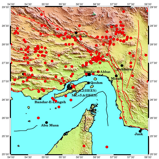
(local time) an earthquake with ML=5.6 on the Richter scale occurred 44 km west
of Qeshm and 57 km southwest of Bandar Abbas. (Figure 1) The magnitude of this
earthquake according to the body wave scale is estimated at Mb=6.1. This seismic
event has been recorded at all 14 broad band seismic stations of the Iranian
National Broad-Band Seismic Network (INSN) at IIEES. Waveforms of this
earthquake can be downloaded from the IIEES website. According to the recorded
seismograms, the location of this earthquake is at 28.87˚N and 55.83˚E. Having
been recorded by the Iranian National Broad-Band Seismic Network (INSN) at
IIEES, over 400 aftershocks have followed the main earthquake in this region
until 6:00 a.m., November 29th.

Figure (1): Epicenter of Nov. 27, 2005 West of Qeshm earthquake
Analysis of
Bandar Abbas region's Seismicity.
Seismic analysis of the 52 km range of the
earthquake shows over 80 earthquakes having occurred with a magnitude greater
than 5 in the last 100 years, the biggest of which was the March 21, 1977
earthquake with Ms=6.9 in northern Bandar Abbas (Figure 2).

Figure (2): Instrumental earthquakes bigger than 5 in the region of Qeshm
Analyses of the focal mechanisms of the main earthquakes in the Bandar Abbas region are shown in figure (3).

Figure (3): Focal mechanisms of the main earthquakes in the Bandar Abbas region.

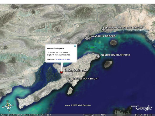
Figure (4): Satellite view of the earthquake epicenter.
Table (1): List of historical earthquakes in Qeshm Island.
|
ID |
D |
Io |
M |
E |
N |
YEAR |
NO |
|
4.6 |
50 |
6.5 |
5 |
55.8 |
26.8 |
1336 |
1 |
|
7.2 |
10 |
6.9 |
5.3 |
56.2 |
26.9 |
1361 |
2 |
|
4.6 |
50 |
6.5 |
5 |
55.8 |
26.8 |
1829 |
3 |
|
3.5 |
100 |
6.5 |
5 |
55.3 |
26.7 |
03/--/1829 |
4 |
|
5.4 |
28 |
6.5 |
5 |
56 |
26.9 |
1884/19/05 |
5 |
|
7.2 |
28 |
8.3 |
6.4 |
56 |
26.9 |
1897/10/01 |
6 |
|
4.6 |
50 |
6.5 |
5 |
55.8 |
26.8 |
1897 |
7 |

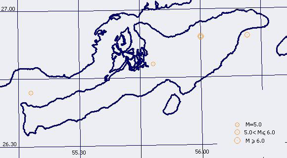
Figure (5): Focal depth of historical earthquakes in Qeshm Island.
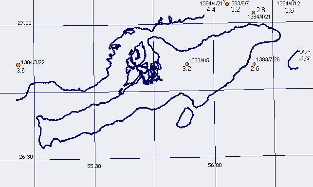
Prior to this date, the last earthquakes having occurred in this region go back to 2004 with magnitude of 2.6 and 3.2 and 2005 with magnitude of 3.6. Characteristics of these earthquakes are shown in Table (2) and their focal depths may be seen in Figure (7).
Table (2): Earthquakes occurring in Qeshm Island during the past 2 years.
|
Date |
Date |
(GMT) |
Local Time |
Latitude |
Longitude |
Magnitude |
Location |
|
1383/4/5 |
2004/06/25 |
19:19:56 |
23:49:56 |
26.85 |
55.89 |
3.2 |
Southwest of Payposht |
|
1383/5/7 |
2004/07/28 |
12:41:02 |
17:11:02 |
27.07 |
56.06 |
3.2 |
North of Darghahan |
|
1383/7/26 |
2004/10/17 |
16:10:20 |
19:40:20 |
26.85 |
56.17 |
2.6 |
Southeast of Berke Khalaf |
|
1384/3/22 |
2005/06/12 |
00:18:54 |
5:00:00 |
26.81 |
55.11 |
3.6 |
Northwest of Basaiedoo |

Figure (6): Focal depth of earthquakes occurring in Qeshm Island in the year 2004.